![]()
What is Pinterest?Cartographers and GIS users are often visual by nature. Pinterest is a tool that allows the visually minded to capitalize on images posted throughout the web. In a nutshell, Pinterest allows a user to “pin” images, found on the web, to virtual pin boards. These pin boards are organized by topic and the images you save to them link back to the original page they were found on.
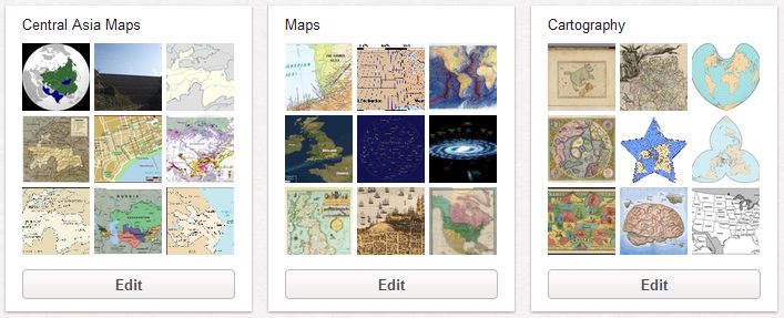 |
| Here are a couple of my pin boards I use for geospatial images and maps |
Pinterest is sometimes thought of as a social network for women interested in home décor or fashion or recipes. To be honest, I first head about the site from my wife who has a food blog. When I saw what you can do with the site, however, I knew I had found a great resource for organizing, saving, and enjoying maps found online. Of course I don’t use it only for maps. I use it to inventory anything of visual interest that I come across including food, clothing and various hobby interests. That, incidentally, is how the site got its name. Users pin their interests.
The social aspect of Pinterest comes with its follow and re-pin functions. This allows you to view images saved by others with similar interests. I have searched Pinterest and while there are a few maps here and there, the geospatial and cartographic communities have yet to really discover the site.
How to Use Pinterest
As of this blog post Pinterest is available as an invite only network. If you know someone who has an account you can get them to send you an email invite. Otherwise, you can use the Request an Invite button on the log in page.
 |
| You can request an invite at Pinterest.com |
After receiving an invite and signing up for the site you will be prompted to install a “Pin It” button extension for your browser. When you are visiting a page with images on it, you can click the Pin It button which gives you the option of pinning some or all of the images found. You can add the images to any board in your Pinterest profile or create a new custom board right then. In addition to the image you are asked to provide a description of the pin.
Users are given several default boards when they sign up. These can be deleted or renamed and new boards can be created. This benefits the cartography connoisseur by providing a framework in which to categorize and link to maps found while perusing the web.
Conclusion
The goal of most social networking communities is to interact and converse on topics of interest. Pinterest is no different and is perfect for those of us with geospatial interests. I have only just begun to utilize the site and hope to see my virtual pin boards grow throughout the year. Let me know what you think of Pinterest as a tool for geospatial users. If you decide to join you can

Update:
The more I use Pinterest and engage with the community, the more geospatially oriented folks I find including Big Map Blog who recently started following my pins.