September is National Emergency Preparedness month. Every year throughout the United States there are fires, floods, storms, earthquakes, industrial accidents and even explosions. Sometimes these situations are contained to a small locality where they are easily managed. Other times, emergencies cover large geographic areas and impact the lives of thousands of people. Maps, imagery and GIS have become increasingly important in preparation for and management of emergency situations at federal, state and local levels.
But geospatial tools in an emergency are not just for organizations like FEMA and public safety departments. Individuals have access today to numerous map resources and they could be using them as insurance in the event that a natural or man made disaster should strike in their area. Below are four maps that could give you the upper hand in such a situation.
Home Floor Plan
Every home needs an evacuation plan. A simple pencil sketch of your house will do as you really just need to show the walls and where doors are located. If you want to get more detailed you could use an online floor plan creator like Autodesk Homestyler. Homestyler lets you build detailed, multi-level, 3D floor plans of your home’s interior.
Current Printed Street Map
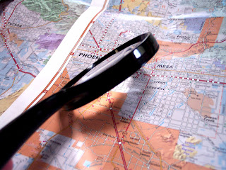
Google Maps are great for finding the shortest distance by road between locations. Along with other mapping applications like Bing Maps and MapQuest, Google Maps are a good first choice for routing yourself or others to safety. However, you always have to remember that in an emergency situation, Internet and/or cell reception could be disrupted. For this reason, among others, having a printed street map of the city you live in and the surrounding area is a good idea.
Street maps can often be purchased through organizations like AAA or in many gas stations located near the entrances to your city. The local chamber of commerce or visitor center often has maps for free or a low price or they can give you further advice on where to go to get a map. It is true that it is getting harder and harder to find good printed paper maps these days but they are still out there.
Safety Map
Maps are great if you know where you want to go. But in an emergency, unless you have a destination in mind of where you can find help or can meet up with loved ones, a map just shows you many ways to nowhere. At Safety-maps.orgyou can take care of the problem.
Safety Maps is a free online tool that helps you plan for this situation. You can use it to choose a safe meeting place, print a customized map that specifies where it is, and share this map with your loved ones.
Safety-maps.org is a great site that is simple to use but serves a great purpose. Making a safety map is extremely easy. You just search for the area you live in (I used a zip code), position a green cross hair on the place designated for meeting and type a message or directions. Then you create your map and print it. You can fold several copies of the map for different people in your family so each will have one no matter where they are or what the situation.
US Road Map
Having a major roads map (or a US road atlas) can help you relocate once you are out of your local area if you need to evacuate quickly. A national level map is also handy for determining the location of disasters outside of your area. Rand McNally is one of the best known makers of quality road atlases.
There you go, four maps that could mean the difference in surviving an emergency situation. Are you prepared? Are there any you would add?