With all of the visualization technology we have available, why do we still find it
necessary to print maps? With desktops, laptops, smartphones and tablets, it would seem that paper map production should be all but extinct. This does not seem to be the case though.
Technology has broadened our access to maps we previously could not obtain and created new mapping products that we might not have even considered before the popularization of personal GIS.
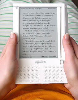
Likewise, when Kindles and later Nooks first started appearing it was said they would herald the demise of the printed and bound book.
We have certainly seen plenty of bookstores go out of business over the last few years but the last time I was in Barnes and Noble there were plenty of books still to be found.
So why do we continue to print what we can simply view instantly and continuously? Here are a few reasons why paper maps are not going away any time soon:
- Paper maps do not freeze up or run out of batteries. A GeoPDF on your tablet is a great tool. It becomes somewhat less effective when your tablet is not working properly.
- Cost of new devices can be an issue. This is becoming less a factor as technology becomes cheaper and plotters, ink and paper prices stay the same or rise. Technology is still a new investment for many organizations, though.
- Paper maps give the big picture. There is only so much of a map that one can fit on a computer screen without having to reduce its on-screen size. It is easier for the brain to process a map of fixed size than to readjust its spatial understanding with a zoom.
- Physical maps are easy to share. A paper map can be passed between several people without worrying about computer access, having the right program installed, formatting and compatibility.
- Humans still desire tangible and tactile things. A paper map has an aesthetic that appeals to the human need for real things.
Let me know what you think about the future of map media.

That’s a very interesting concept. It does seem that paper maps may die out eventually. However, there will always be those few people who don’t like technology. Will those few people be able to keep the paper map industry alive? who knows… I was once in Berkeley just to have a look around (being a tourist I guess). I hopped on the bart and got off about a mile from downtown. I didn’t know where I was, so I went in a gas station and bought a paper map. I don’t have an iphone or anything like that, and I’m not planning on getting one anytime soon, so for me it was great that I could still buy a paper map at the gas station…
~Lisha
p.s. I replied to your comment at http://onlinemoneytrip.blogspot.com/2011/08/few-ways-to-write-blogs-to-create.html Thanks for leaving a comment 🙂
Lisha, thanks for commenting. There are so many different types of maps (road , economic, resource, physical, engineering, political, rainfall and topographic…. ) and so many varied applications for them that I think it is likely some will be more readily accepted in digital form and some in a printed form.
Only time will tell but hang on to that paper map you bought.
Ryan